
Integrated Radar Traffic Monitoring System with Built-in Vehicle Classification
跳转至页面部分:
概览
简介
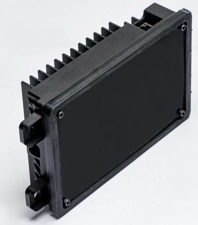
SRIR144V2T is a real-time speed enforcement/traffic monitoring radar system for smart cities and intelligent transportation systems. SRIR144V2T offers a plug-and-play unit for controlling and visualizing. Radar can map both stationary terrain and moving objects simultaneously. SRIR144V2T tracks hundreds of moving objects and reports the location and the on-the-road speed of the vehicles with high accuracy. SRIR144V2T automatically corrects the speed for the radar location and radar mounting biases on the speed. SRIR144V2T is built on the industry-leading 76-81GHz integrated CMOS transceiver SVR4414.
SRIR144V2T release package includes a Chrome browser-based GUI which acts as both controller and viewer/renderer. For direct processing with an ANPR, we provide the track information at a trigger distance. Vehicle information such as location and speed is reported per frame when it crosses the user-defined trigger line. The GUI can control the radar unit and set the configurations such as operating bandwidth and operating mode, SRR vs LRR. Users can track both incoming and outgoing traffic separately. Users can also define the lanes to filter out curb traffic, merge lanes, etc.
The design is IP67 certified to withstand the natural elements.
特性
- 4D Imaging - Antenna array for 1.2° azimuth and 6.5° elevation beam width
- Multimode support - Wide field of view of 120° in azimuth and 30° in elevation
- Quick evaluation - GUI for data collection and FoM testing
- Real-Time application - 15 fps refresh rate through standard ethernet interface
- Single platform for short/medium (<75m) and long range (300m)
- Maximum speed of +/-320 Km/H
- Speed resolution of 0.27 m/s
- Range resolution of 0.3m (<75m) and 0.60m (long range)
- Range resolution of 0.15m to 300m in near-term roadmap
- EMI/EMC certified
- Certified for speed accuracy
- Ethernet and RS485 interface
产品对比
应用
应用
- Speed enforcement
- Traffic monitoring
- Smart cities
- Intelligent transportation systems
设计和开发
模型
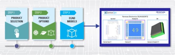
ECAD 模块
Schematic symbols, PCB footprints, and 3D CAD models from SamacSys can be found by clicking on products in the Product Options table. If a symbol or model isn't available, it can be requested directly from the website.
Processing table
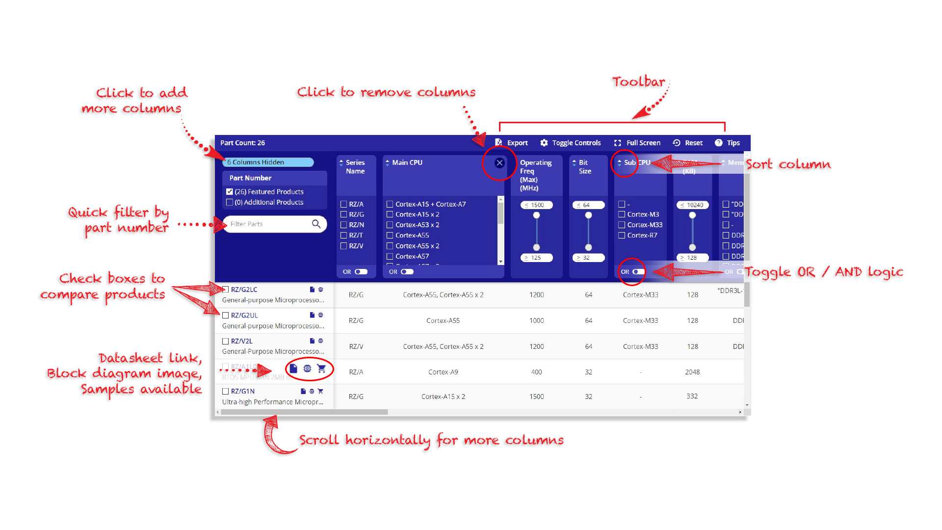
Tips for Using This Parametric Table:
- Hide Filters button in header: Collapse or expands filters
- Column sort buttons in header: Sort Column alphabetically / numerically descending or ascending
- Reset button in header: Reset all filters to the page default
- Full Screen button in header: Expand the table to full screen view (user must close out of full screen before they can interact with rest of page)
- Export button in header: Export the filtered results of the table to an Excel document
- Filter parts search bar in header: Type to filter table results by part number
- Hide column button in column headers: Select to hide columns in table
- AND / OR toggle switches in header: Toggles the logic of this particular filter to be “AND” or “OR” logic for filtering results
- Multiselect checkboxes at beginning of each row in table: Select these checkboxes to compare products against each other
- Document icon next to product name in row: View the featured document for this product
- Chip icon next to the right of the document icon in row: View the block diagram for this product
- Cart icon to the right of the chip icon: Indicates that samples are available for this product
视频和培训
4D Imaging Radar Overview
This video demonstrates the utilization of the 4D Imaging Radar in autonomous driving and industrial (traffic) applications. Discover how this advanced radar technology provides highly accurate and high-resolution point clouds along with the precise shape and size of the objects. Features such as elevation detection, pedestrian detection, and ego estimation enable drivers to benefit from advanced driver assistance systems, even under challenging weather and visibility conditions.
Related resources:
Video List